
↓
 

Atlanta Land Surveying

Your First Choice for a Local Land Surveyor

Atlanta Land Surveying
  • Home
  • ALTA Survey
  • Boundary Surveying
  • Construction Survey
  • Drone LiDAR Mapping
  • Elevation Certificate
  • Land Surveying
  • Topographic Survey
  • Blog
  • Contact Us
Home - Page 7 << 1 2 … 5 6 7 8 9 10 11 >>

Post navigation

← Older posts
Newer posts →

Difference in FEMA Elevation Certificate and LOMA

Atlanta Land Surveying Posted on March 6, 2017 by AtlantaSurveyorJuly 17, 2018

I get calls all the time from someone requesting an Elevation Certificate or Elevation Survey. Usually it’s because they’ve gotten a letter in the mail from their mortgage company telling them they have to get flood insurance. This leads them to contact their insurance company and that leads to a surveyor.

“purchasing flood insurance is mandatory…if the loan is federally insured or the lender is regulated by the federal government”

Purpose of the Elevation Certificate
FEMA Elevation CertificateAn Elevation Certificate is a form “…used to provide elevation information necessary to ensure compliance with community floodplain management ordinances, to determine the proper insurance premium rate, and to support a request for a Letter of Map Amendment (LOMA)…” Make sure that your surveyor uses the latest version of this form as it’s currently being revised (March 2016).

Surveyor Measures the Elevations

The surveyor determines the lowest floor elevation of the house, the lowest adjacent grade (LAG) elevations of the house, the elevation of the lowest element attached to the house (like a porch step,) and the lowest elevation of machinery or equipment servicing the building. The surveyor also identifies the building type according to the instructions in the Elevation Certificate form.

Base Flood Elevation Determined

After these are measured, then the Base Flood Elevation (BFE) is determined from either the Flood Maps (FIRM), the Flood Insurance Study (FIS), or by the local community. The difference in elevation between this BFE and the LAG and/or Lowest Floor will determine the insurance premium rate.

LOMA Removes Flood Insurance Requirement

Even if an Elevation Certificate shows that your house is above the Base Flood Elevation at all points, you still have the requirement to obtain flood insurance. Only after the submission and approval of a Letter of Map Amendment (LOMA) can the Flood Map be amended and the Federal mandate for the purchase of flood insurance be removed.GIS with Flood Hazard Zone Overlay
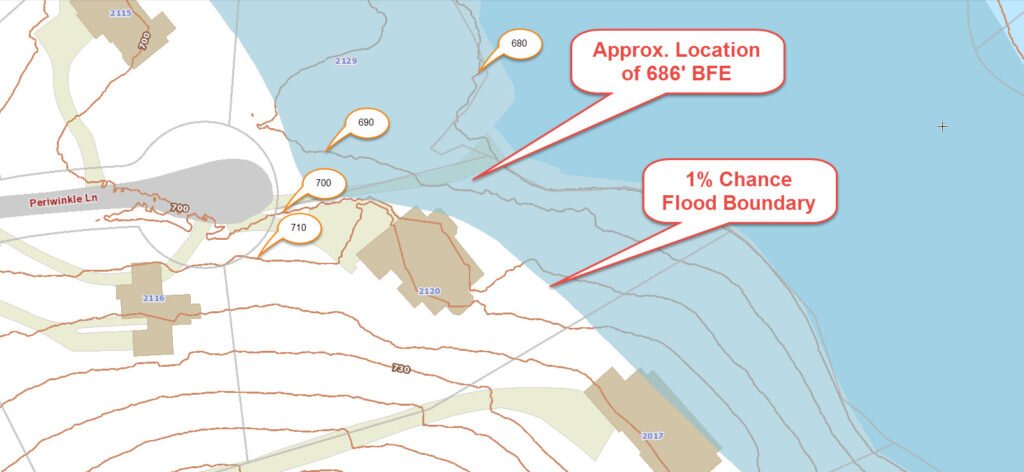
The LOMA process can be done online and typically takes 30 days or less but sometimes a review of the LOMA submission can identify additional information that is needed.

It should be noted that the Elevation Certificate must be completed by a Land Surveyor, Engineer, or an Architect who is authorized by law to certify elevation information, though I don’t know of any Architects that will do these, and not too many Engineers.
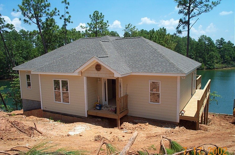
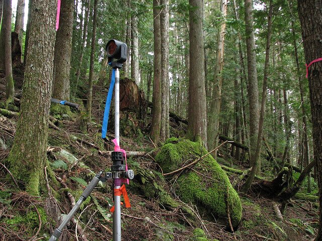
To talk about an elevation survey for getting flood insurance for your home or business, please call ​(404) 998-4474 or fill out our contact form to the right.

Posted in elevation certificate, flood survey | Tagged elevation certificate, elevation survey, flood survey, flood zone

Things to Know When Building Your House

Atlanta Land Surveying Posted on September 14, 2016 by AtlantaSurveyorFebruary 20, 2018

Land Surveying in Building your house

It is a very good idea to build your home because you will be able to get exactly what you want instead of when you buy. Of course, you may need to add some things or you may not know what you are getting yourself into.

It is a huge decision choosing the right builder since it is one of the largest personal investments that you will make. Be sure to give an interview to all of the possible contractors and then pick the one that will help make your dream home come true. While you are talking to the possible contractors be sure you ask all of the pertinent questions that will help you choose the best; their how long they have been in the business, experience,  what are the kind of buildings that they have experience building and it would be great if you can see some of their work. It is also crucial to pick house plans which may lead to a good home now and in the future. This is something that your contractor should be able to help you with and they may call on the services of an architect.

Budget in building your house

Before to planning your house design consider these factors; your budget, the size of the home to be built, location of the home, wall finishes, design features that you would like, ceiling height, number of stories, fixture types, exterior finishings, also your time frame.

If you happen to be uncertain about any of these items, your contractor or architect should be able to guide you through this very important process. They will help you choose the details that are right for you down to the very smallest detail. They may refer you to other consultants for things like finishes, colors, and the like so be prepared to sit and discuss with them for a few hours to talk about all these choices that you may have.This is the reason that your choice of a builder is important.

If your builder isn’t able to advise you on home location they should refer you to a real estate agent. A real estate agent is familiar with important details like neighborhood home values, school districts, traffic issues, funding options, etc.

Land Surveying: avoids future problems

Another stop you should make is to see a land surveyor. Land surveyors are trained and experienced in identifying features of the land that might have an impact on your new home – called land surveying. Some of these features are flood zones, property line encroachments from neighbors, lot dimensions, and building setbacks. Land surveyors are measurement experts. And, since your home is your most valuable asset, land surveying should be one of your first steps in any new construction.

To talk to a land surveyor before building, please call ​(404) 998-4474 or fill out our contact form to the right.

Posted in construction, land surveying, land surveyor | Tagged building a house, house construction, land surveyor

The Basics of Land Surveying

Atlanta Land Surveying Posted on August 11, 2016 by AtlantaSurveyorFebruary 20, 2018

land surveying

What is Land Surveying?

Land Surveying dates back to ancient history. Surveying is used for multiple projects.  A survey is done to establish a specific location of a parcel of land along with its exact acreage.  It is used to ascertain boundaries for defining an area of ownership and tax liability.  It is also used to identify a piece of property by a written legal description or to provide a review of the accuracy of an existing description. Data from land surveying is of the utmost importance with regard to buying and selling land, and is also used to insure a clean and marketable title.

Other types of Land Surveying

There are many different kinds of surveys that can be performed. Boundary surveying is typically done for undeveloped land. This type of survey measures the actual physical extent of the property in question. Most surveys progress through the basic procedures regardless of the type being done. Any pertinent deeds, contracts, maps or other documents that contain a description of the property’s boundaries are located, studied and interpreted.

A determination is made of what the actual property description is deemed to be, along with the locations of any physical evidence of the boundaries. This can be in the form of both natural and man-made monuments or markers that exist in the field.

The property is then measured to establish the boundaries, not only using the appropriate existing monuments but with the creation and referencing of new markers where necessary. Measurements are accomplished using a total station and other land surveying tools. A total station measures both vertical and horizontal angles, as used in triangulation networks. After these steps are accomplished, the property description and plat are prepared.

Results of land surveying

Interpreting the results of a land survey is not as difficult as it may first seem. For instance, a property plat will usually contain a directional orientation which is typically indicated with an arrow pointing north. It will contain the bearing and distance of each boundary line, the property lines of other properties shown on the plat, and the names of adjacent property owners listed in the areas of their property.

Corner monuments, along with the names of any natural monuments (such as “Smith’s Creek”, for example) or a brief description of any unnamed natural monuments (such as the “30-inch pine tree”) are on the plat. There is also a title block containing the property’s location and name of owner, the surveyor’s name, the date the survey was performed, the scale of the plat and any other relevant data.

If you need the services of a surveyor for your land surveying needs, ALWAYS be sure that you’re hiring an experienced, certified, and highly competent professional surveyor. You can find out if the surveyor is licensed by visiting the Georgia Board of Licensure’s website.

To talk about your land surveying, please call ​(404) 998-4474 or fill out our contact form to the right.

Posted in land surveying, land surveyor | Tagged boundary survey, land survey, Land Surveying

Post navigation

← Older posts
Newer posts →
Get Quote Button
© Boxer Survey USA
Atlanta Land Surveying

Atlanta, GA
Phone: (404) 998-4474

Web Development and SEO by:
AuburnBusiness.com, LLC


Privacy Policy | Terms of Use

The owner of this website, Boxer Survey USA, provides coordination of professional land surveying and engineering services in all 50 states. The professional surveying and engineering services provided to you will be conducted by fully licensed professionals in your state.

&nbsp
↑