↓
 

Atlanta Land Surveying

Your First Choice for a Local Land Surveyor

Atlanta Land Surveying
  • Home
  • ALTA Survey
  • Boundary Surveying
  • Construction Survey
  • Drone LiDAR Mapping
  • Elevation Certificate
  • Land Surveying
  • Topographic Survey
  • Blog
  • Contact Us
Home - Page 5 << 1 2 3 4 5 6 7 … 10 11 >>

Post navigation

← Older posts
Newer posts →

Why Your Lender Is Asking for an ALTA Survey And What It Means 

Atlanta Land Surveying Posted on May 27, 2026 by AtlantaSurveyorMay 20, 2026
Buyer and lender reviewing ALTA survey documents and commercial property plans before closing on a real estate transaction

If your lender or title company just asked for an ALTA survey, you are probably wondering what that is and why it matters. Most buyers have never come across one before. 

What Is an ALTA Survey?

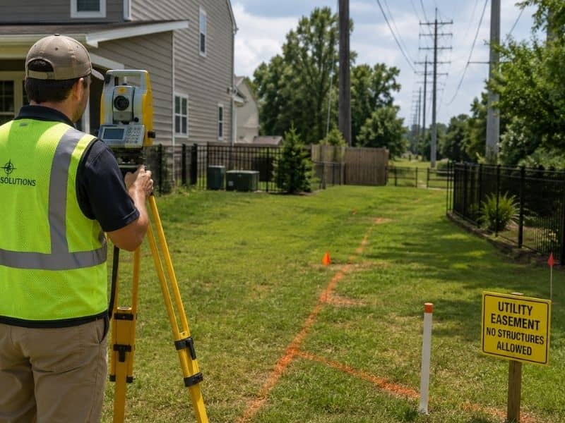
An ALTA survey is a detailed type of property survey. It follows rules set by two national groups: the American Land Title Association (ALTA) and the National Society of Professional Surveyors (NSPS). It maps property lines, buildings, easements, and flood zones. Most lenders and title companies require it when you buy commercial property.

An ALTA survey is the most detailed land survey you can get in the United States. It follows a set of national rules last updated in 2021. Every licensed surveyor in the country uses the same standard, so lenders and title companies trust it no matter which state the property is in.

What Does an ALTA Survey Include?

An ALTA survey shows property lines, buildings, fences, driveways, easements, flood zone info, and zoning rules. Buyers and lenders can also add optional items, called “Table A” items, such as parking counts or underground utility research.

Every ALTA survey must include:

  • Property lines and corner markers
  • Buildings, driveways, fences, and other structures on the land
  • Easements, which are rights that allow others to use part of the property
  • Any place where a neighbor’s structure crosses onto the property
  • Ways to enter and exit the property from a public road
  • The property’s flood zone status based on FEMA maps
  • Local zoning rules and required setback distances

Buyers and lenders can also request extra items through the ALTA/NSPS Table A, such as parking counts, wetland markers, and utility research. Your surveyor will help you choose the right ones.

ALTA Survey vs. Boundary Survey

A boundary survey only shows property lines. An ALTA survey shows property lines plus buildings, easements, flood zones, and zoning details. ALTA surveys follow a national standard. Boundary surveys vary by state.

FeatureBoundary SurveyALTA Survey
Property linesYesYes
Buildings mappedNoYes
Easements shownPartialFull
Follows national standardNoYes
Accepted by title companiesLimitedYes, in all 50 states
Typical useResidentialCommercial

For most home purchases, a boundary survey is all you need. If you are buying commercial property, your lender will almost always require a full ALTA survey.

Who Needs an ALTA Survey?

You need an ALTA survey if you are buying commercial property, refinancing a commercial loan, or if your lender or title company asks for one. It is rarely needed for regular home purchases.

You will likely need an ALTA land survey if you are:

  • Buying a commercial property
  • Refinancing a commercial loan
  • Getting title insurance on a property with a complicated history
  • Building on commercial land
  • Completing a 1031 exchange or a sale-leaseback deal

If you are buying a regular home, you probably do not need one. But if the property is large, rural, or has a history of boundary disputes, your lender may ask for it anyway.

How Much Does an ALTA Survey Cost?

In Atlanta, an ALTA survey usually costs between $2,000 and $10,000 or more. The price depends on how big the property is, how complex it is, and which Table A items are added. Always get a written quote before you hire a surveyor.

Property TypeEstimated Cost Range
Small commercial lot (under 1 acre)$2,000 to $4,500
Mid-size parcel (1 to 5 acres)$4,500 to $7,500
Large commercial site (5 or more acres)$7,500 to $15,000 or more

The price also goes up if there are no old survey records, if the land is hard to reach, or if you need the results quickly. Always get a written quote before any work begins.

How Long Does an ALTA Survey Take?

An ALTA survey usually takes two to six weeks. The timeline depends on how complex the property is and how fast public records can be pulled. Some firms offer faster service if your closing date is coming up soon.

The process moves in steps: gathering documents, researching public records, visiting the property, drawing the survey map, and delivering the final report. If you have a set closing date, tell your surveyor right away so they can manage the schedule.

Why Buyers Need an ALTA Survey

Atlanta has grown fast over the past 30 years, and that growth brings risk for buyers who skip their research. An ALTA survey can find problems that a simple deed review will miss, such as:

  • Easements from MARTA, Georgia Power, or city utility lines that run through the property
  • A neighbor’s fence, wall, or building that crosses onto the land
  • Flood zone changes near Peachtree Creek or the Chattahoochee River
  • Buildings that no longer meet current zoning rules or setback distances

Knowing about these issues before closing gives you a chance to ask questions, renegotiate, or walk away. Finding out after the deal is done is far more costly.
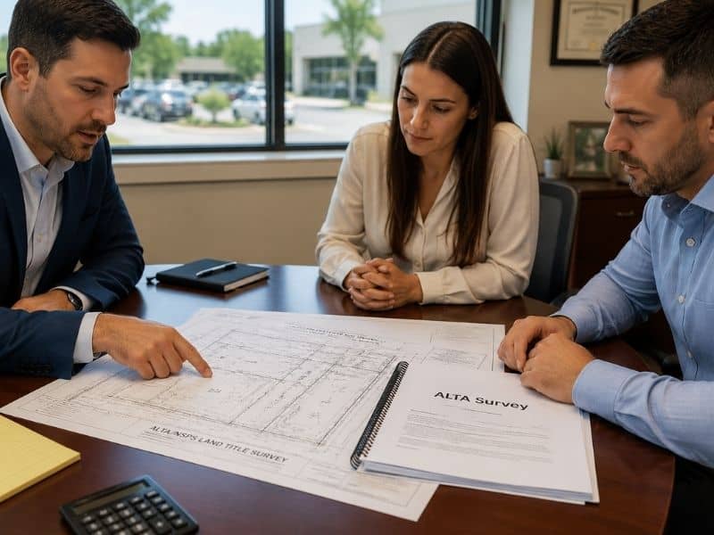
Get an ALTA Survey 

An ALTA land survey gives you a clear picture of what you are buying. It protects you, your lender, and your title company before any money changes hands.

When hiring a surveyor, make sure they hold an active Professional Land Surveyor license and have experience with ALTA surveys. Ask for a written quote and confirm they can meet your closing timeline.

Frequently Asked Questions

Can I use an old ALTA survey for a new deal? 

Most lenders want a survey that is no older than six months. In some cases, a surveyor can update and re-sign an old one. But many lenders will require a brand new survey, so check with your lender first.

Who pays for the ALTA survey? 

In most deals, the buyer pays for the ALTA survey as part of their research costs. In some cases, the seller and buyer split the cost. It depends on what both sides agree to.

Does an ALTA survey show underground utilities? 

It shows underground utilities only if they can be seen on the surface or found in public records. You can add Table A Item 11 to include more utility research. But an ALTA survey is not the same as a utility locate service.

Posted in alta survey | Tagged alta survey

LiDAR Mapping Is Changing Land Surveying. Here’s How

Atlanta Land Surveying Posted on May 25, 2026 by AtlantaSurveyorMay 20, 2026
Drone performing LiDAR mapping over a wooded property with terrain scanning technology and city skyline in the distance

LiDAR mapping is changing the way land surveyors do their work in Atlanta, Georgia, and across the country. You may have heard the term but never knew what it meant. 

What Is LiDAR Mapping?

LiDAR mapping uses laser light to measure distances and build a detailed 3D picture of the ground. The system fires millions of laser pulses and records where each one lands. Surveyors use this data to create accurate maps of land, buildings, and terrain.

LiDAR stands for Light Detection and Ranging. Think of it like a very fast, very precise tape measure that uses light instead of a physical tape.

The sensor fires thousands of tiny laser pulses every second. Each pulse travels to a surface, bounces back, and returns to the sensor. The system records how long that trip takes. From that, it can calculate the exact distance to that point.

Do this millions of times across a piece of land, and you get a huge collection of distance measurements. Surveyors call this a point cloud. It is basically a dot-by-dot 3D picture of the area.

How Does LiDAR Work?

LiDAR works by shooting laser pulses at the ground and measuring how long each one takes to come back. A GPS unit records the sensor’s exact location during the scan. Software then takes all those return times and turns them into an accurate 3D map of the scanned area.

Here is something really useful about LiDAR. It can see through trees. Some laser pulses pass through gaps in the leaves and hit the ground below. This means surveyors can map the actual ground surface even under a thick forest. That is very helpful in Atlanta, where trees cover a lot of the land.

According to the USGS 3D Elevation Program, some LiDAR systems can fire up to one million laser pulses per second. That kind of speed makes it possible to map large areas in just a few hours.

How Is LiDAR Used in Land Surveying?

Land surveyors use LiDAR to map large areas of land quickly and accurately. It helps with terrain mapping, construction planning, large property surveys, and drainage work. LiDAR is most helpful on big projects or sites with rough terrain that would take much longer to survey using traditional methods.

Here are the main ways surveyors use LiDAR on real projects:

Terrain and Elevation Mapping. LiDAR collects elevation data fast. It shows hills, slopes, low spots, and drainage paths across a property. Site planners and engineers use this to figure out how to grade a site or manage stormwater.

Construction Projects. Before building starts, LiDAR gives a full picture of the land as it is right now. During the project, it can track how much dirt has been moved. After the build, it helps document what was actually constructed.

Large Land and Road Surveys. Some projects cover hundreds of acres. Others run for miles, like roads or pipelines. A drone with a LiDAR sensor can cover that ground in a single flight. That saves a lot of time compared to walking the whole area with traditional equipment.

Drainage and Water Flow Analysis. In Atlanta, stormwater is a big deal. LiDAR gives surveyors exact elevation data so they can see how water will move across a site. This helps engineers design the right drainage systems before any dirt is moved.

LiDAR Mapping in Atlanta, Georgia

LiDAR mapping in Atlanta, Georgia helps surveyors work through the city’s hilly ground, thick trees, and many streams and creeks. Atlanta is growing fast, and LiDAR helps licensed surveyors collect the accurate data they need for site planning, drainage design, and large construction projects across the metro area.

Atlanta has some tricky land to survey. The city has rolling hills, red clay soil, and dozens of streams running through neighborhoods and open land. It also has a thick tree canopy that covers much of the metro area.

LiDAR handles all of that well. It maps through the trees and captures the real ground surface below. Many counties in Georgia now have publicly available LiDAR data through the USGS 3D Elevation Program. This means surveyors can often start a project with a solid base map already in hand.

The global LiDAR market was valued at about 1.8 billion dollars in 2023. It is expected to grow past 6 billion dollars by 2030. That growth shows how widely this technology is being used across construction, engineering, and land surveying.

LiDAR vs. Traditional Surveying

LiDAR does not replace traditional surveying. It works alongside it. Here is a simple side-by-side comparison:

FeatureLiDAR MappingTraditional Surveying
SpeedCovers large areas fastTakes longer on big sites
Data collectedMillions of points at onceOne point at a time
Works through treesYesNeeds physical access
Legal boundary linesCannot set legal linesRequired for legal plats
Best forTerrain, construction, large sitesBoundaries, lot corners, small parcels

A licensed land surveyor must still review all data, set property corners, and sign off on any legal survey documents.

Do You Need LiDAR for Your Survey?

LiDAR is a good fit when:

  • Your property is over an acre and needs detailed terrain data
  • A construction project needs cut-and-fill earthwork calculations
  • The site sits near a creek or low-lying area where elevation matters
  • The project covers a long stretch of land like a road or utility line
  • Heavy tree cover limits the use of aerial photos

For a standard home boundary survey or a small lot survey, traditional methods are usually the better and more affordable choice. Ask a licensed land surveyor which approach fits your project best.

Frequently Asked Questions

What does LiDAR stand for? 

LiDAR stands for Light Detection and Ranging. It uses laser pulses to measure distances and build 3D maps of land and structures.

Can LiDAR set my legal property line? 

No. A licensed land surveyor must research deeds, plat records, and field evidence to set legal property lines. LiDAR helps support that work but cannot replace the legal process.

How accurate is LiDAR mapping? 

Good LiDAR systems can reach vertical accuracies of 1 to 5 centimeters. Accuracy depends on sensor quality, how high the drone flies, and whether proper ground control points were set by a licensed surveyor.

Who can do LiDAR mapping?

LiDAR survey products must be produced by or under the supervision of a licensed land surveyor in Georgia. Make sure your provider is licensed through the Georgia State Board of Registration for Professional Engineers and Land Surveyors.

Posted in land surveying | Tagged lidar mapping

Property Easements Explained for Landowners 

Atlanta Land Surveying Posted on May 22, 2026 by AtlantaSurveyorMay 20, 2026
Licensed land surveyor reviewing property boundaries and easement areas near a residential property

A property easement is one of the most misunderstood terms in real estate. Many homeowners do not know an easement exists on their property until a surveyor or title company points it out. Understanding what easements are and how they affect your land can save you from costly surprises.

What Is a Property Easement?

A property easement is a legal right that allows someone else to use a portion of your land for a stated purpose. The person or organization with the easement does not own the land. They simply have the right to use it. The easement is tied to the land, not the owner.

An easement is a legal agreement recorded in property records. It gives a person, company, or government agency the right to use part of your land. That right stays with the land even when the property is sold, meaning a new owner takes on any existing easements.

For example, a utility company may have an easement across the back of your property to access power lines. You still own the land, but the utility company has the legal right to enter and work in that area when needed.

Common Types of Property Easements

The most common types of property easements are utility easements, drainage easements, access easements, and conservation easements. In Atlanta, utility and drainage easements are especially common due to the region’s dense infrastructure and stormwater management requirements. Each type limits how the property owner can use that portion of the land.

There are several types of easements that may appear on a property survey or title report.

Utility Easement.This is the most common type. It gives power companies, gas providers, or water and sewer utilities the right to access part of your land. You cannot build permanent structures in this area.

Drainage Easement.This allows water to flow across your property through a set path. Local governments often require drainage easements to manage stormwater. Property owners cannot block or fill these areas.

Access Easement. Also called an ingress and egress easement, this gives a neighboring owner the right to cross your land to reach a road or another property. This is common on rural tracts and subdivided land across metro Atlanta.

Conservation Easement. A landowner voluntarily gives up certain development rights to protect the natural features of the land. These preserve wetlands, forests, and farmland. The Georgia Department of Natural Resources reports that conservation easements have protected more than one million acres across the state.

Private Easement. This is an agreement between two private property owners. One owner grants the other specific rights to use a section of their land for a stated purpose.

How Does an Easement Affect Your Property?

A property easement can limit what you build, where you plant trees, and how you use a section of your land. In Atlanta, building a structure inside a utility or drainage easement can result in fines, forced removal, and legal liability. Easements can also affect your property value and financing options.

Easements can have real impacts on how you use and develop your property. Here are the most common effects:

  • Building restrictions. Most easements prohibit permanent structures, fences, or landscaping within the easement area.
  • Maintenance access. The party holding the easement has the right to enter your property for repairs or clearing.
  • Property value. Easements in buildable areas can reduce market value. Buyers may pay less for land with significant restrictions.
  • Financing issues. Some lenders will not approve a loan if an easement seriously limits the use or value of the property.
  • Legal disputes. If a property owner builds inside an easement area, the easement holder can take legal action to have it removed.

How Are Easements Found on a Property?

Easements are found through a title search, a recorded plat map, or a land survey. In Atlanta, a boundary survey or ALTA/NSPS survey will identify and map all easements on a property. This is one of the most important reasons to get a survey before buying or developing any land.

Easements are recorded in county public records. Here are the main ways they are discovered:

  • Title search. A title company or real estate attorney reviews recorded deeds to find any easements tied to the property.
  • Recorded plat. Subdivision plats filed with the county often show drainage, utility, and access easements on the map.
  • Land survey. A licensed land surveyor will locate and map all easements on the property so you can see exactly where they fall in relation to your structures and open land.

In Georgia, both the buyer and the lender have a strong interest in knowing about easements before closing.

Can a Property Easement Be Removed?

A property easement can sometimes be removed, but it is not easy. In Atlanta, removing an easement typically requires a written agreement between both parties, a legal process called easement termination, or proof that the easement is no longer needed. A real estate attorney and a licensed land surveyor are usually involved in this process.

Easements do not go away on their own. However, there are a few ways they can end:

  • Written release. The party holding the easement agrees in writing to give it up. This must be recorded with the county.
  • Merger. If the same person owns both properties involved, the easement may end automatically.
  • Abandonment. If the easement goes unused for a long time with clear intent to abandon it, a court may declare it terminated.
  • Expiration. Some easements have a time limit. Once that period ends, the easement is no longer valid.

Speak with a licensed real estate attorney if you believe an easement should be removed or is being misused.

Frequently Asked Questions

Does an easement mean someone else owns part of my land?

No. An easement does not transfer ownership. The property owner still owns the land. The easement only gives another party the right to use that portion for a specific purpose.

Will an easement show up on my property survey? 

Yes. A licensed land surveyor will identify and map all recorded easements during a boundary or ALTA/NSPS survey. This is one of the key reasons to get a survey before buying or building.

Do easements transfer to a new owner when a property is sold?

Yes. Easements run with the land, not the owner. All existing easements transfer to the new owner automatically at closing. This is why reviewing easements during a title search and survey matters so much before you buy.

Posted in boundary surveying | Tagged boundary survey

Post navigation

← Older posts
Newer posts →
Get Quote Button
© Boxer Survey USA
Atlanta Land Surveying

Atlanta, GA
Phone: (404) 998-4474

Web Development and SEO by:
AuburnBusiness.com, LLC


Privacy Policy | Terms of Use

The owner of this website, Boxer Survey USA, provides coordination of professional land surveying and engineering services in all 50 states. The professional surveying and engineering services provided to you will be conducted by fully licensed professionals in your state.

&nbsp
↑