↓
 

Atlanta Land Surveying

Your First Choice for a Local Land Surveyor

Atlanta Land Surveying
  • Home
  • ALTA Survey
  • Boundary Surveying
  • Construction Survey
  • Drone LiDAR Mapping
  • Elevation Certificate
  • Land Surveying
  • Topographic Survey
  • Blog
  • Contact Us
Home - Page 4 << 1 2 3 4 5 6 … 10 11 >>

Post navigation

← Older posts
Newer posts →

Boundary Survey Price: Why Your Neighbor Paid Less Than You

Atlanta Land Surveying Posted on June 4, 2026 by AtlantaSurveyorJune 3, 2026
Land surveyor working near a property line between neighboring homes for a boundary survey price quote

It happens all the time. You ask around before ordering a boundary survey price quote, and someone on your street mentions they paid $600. Your quote comes back at $1,100. Same neighborhood, similar lot size, same firm. What gives?

The answer comes down to what the surveyor actually finds when they start working on your property specifically. Here’s a plain-language explanation of why boundary survey prices vary so much, even between neighboring lots.

Your Neighbor’s Survey and Yours Are Not the Same Job

A boundary survey price is built around the specific conditions of each individual parcel, not a square footage formula or a neighborhood flat rate. Two adjacent lots can present completely different challenges depending on:

  • When each lot was last surveyed
  • Whether corner monuments are still in place
  • What the deed language says and how clearly it matches the plat
  • What improvements have been added over the years
  • How much vegetation is on the lot

When your neighbor’s survey went smoothly because their iron pins were right where the plat said they’d be and their deed was clean, it was a faster job. If your lot hasn’t been touched since 1978, the monuments have been paved over, and there’s a fence that doesn’t match the record, you’re looking at considerably more work.

The Real Components of a Boundary Survey Price

Understanding the line items behind a boundary survey quote helps you evaluate whether what you’re being charged is reasonable.

Records Research. This is the starting point for every boundary survey. Your surveyor pulls your deed, the recorded plat for your subdivision, neighboring deeds, and any prior survey work on file. In Georgia, this often means searching records through the county recorder, the Georgia Superior Court Clerk’s Cooperative Authority, and in some cases, older courthouse archives.

Properties in Atlanta’s established neighborhoods such as Virginia-Highland, Inman Park, or West End sometimes have deed chains going back generations. Tracing those accurately takes time, and that time is reflected in the price.

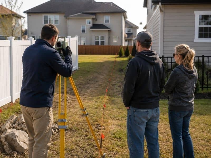
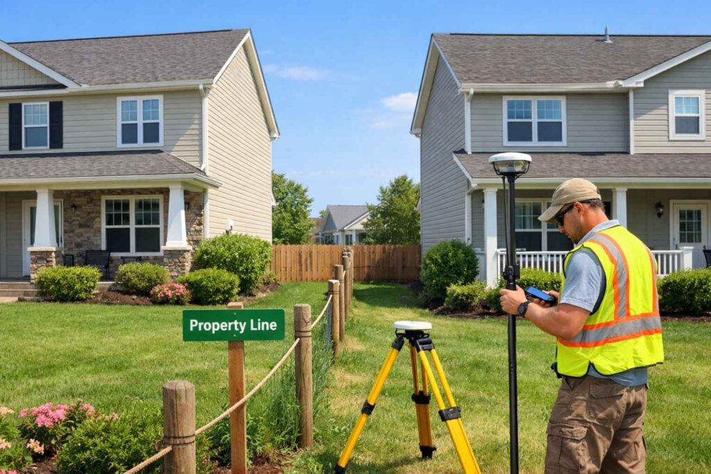
Monument Search and Fieldwork. Once the research is done, the crew goes out to look for your corner monuments. If they find all four corners right where the records say they should be, the fieldwork is efficient. If monuments are missing, buried under a driveway, or have been disturbed by past construction, the surveyor has to reconstruct the boundary from surrounding evidence. That reconstruction process is more involved and drives the price up.

Monument Setting. If corners need to be re-established, new iron pins or concrete monuments are set. Some surveys include this in the base price; others bill it separately. It’s worth asking about before you sign a contract.

Plat Drafting and Certification. After fieldwork, the boundary plat is drafted in the office, reviewed for accuracy, and stamped by a licensed land surveyor. This is what makes it a legally valid document. The complexity of the plat, meaning the number of corners, the type of description, and whether any encroachments or easements need to be noted, affects how long this step takes.

Factors That Make Your Price Higher Than Your Neighbor’s

Here are the most common reasons one property in the same neighborhood comes back with a higher quote than the one next door.

Older deed language. Metes and bounds descriptions using old compass bearings, chains, and rods require more interpretation than a modern plat description. If your deed references landmarks that no longer exist (“from the old oak tree”), your surveyor has to work harder to establish the boundary.

Missing corner evidence. Every corner that needs to be re-established from scratch adds time and cost. If your lot has four corners and none of them can be found, you’re paying for four new monuments plus the calculation work to figure out where they go.

Prior encroachments on record. If a previous survey noted a fence line that doesn’t match the boundary, or a structure that sits partially over a property line, that complicates the current survey and usually requires additional documentation.

Wooded or sloped terrain. Heavy tree cover limits the sightlines survey equipment relies on. Hillside lots require more setup points to capture accurate measurements across changes in elevation.

Your property history. Lots that have been split, combined, or had easements added over the years carry a more complicated paper trail. More paper trail means more research time.

How to Get a Fair Price Without Overpaying

A few practical steps that help you evaluate boundary survey quotes:

Get at least two quotes. Prices vary between firms, and a second quote gives you a baseline for comparison. Make sure both quotes are for the same type of survey and the same deliverable.

Pull together your existing documents. Providing your deed, any prior survey, and your title insurance policy upfront saves your surveyor research time. Anything that reduces their office work reduces your bill.

Ask what’s included. Specifically ask whether monument setting, a recorded plat, and a written legal description are included in the quoted price or billed as extras.

Don’t make price the only criteria. A licensed land surveyor who has worked extensively in your area knows the local records, common issues, and how neighboring surveys have been done. That local knowledge is worth something.

FAQ

Why do some firms charge flat rates and others charge hourly? 

Both are common. Flat rates work well for standard subdivision lots where the scope is predictable. Hourly pricing is more common on older properties or rural parcels where the amount of research and fieldwork is harder to estimate in advance. Neither approach is better or worse. What matters is that the scope of work is clearly defined before work begins.

Should I be worried if my quote is significantly lower than others? 

Worth a closer look. A very low quote sometimes means a narrower scope. Make sure it includes monument setting if needed, a proper plat, and a licensed surveyor’s stamp. Cutting corners on a boundary survey can create bigger problems down the road.

Does the time of year affect boundary survey pricing in Atlanta? 

Generally not as dramatically as in northern states, but Georgia’s summer heat and winter rain can occasionally affect scheduling. Periods of very heavy vegetation growth in summer can sometimes slow fieldwork on heavily wooded lots.

How do I know if my boundary survey price is reasonable? 

For a standard residential lot under one acre with reasonably clean records, anything in the $600 to $1,200 range is typical. If you’re quoted significantly above $1,500 for a simple subdivision lot, ask for a breakdown of what’s driving the cost.

Posted in boundary surveying | Tagged boundary survey

Land Survey Cost: What to Expect Before You Call Anyone

Atlanta Land Surveying Posted on June 3, 2026 by AtlantaSurveyorJune 3, 2026
Property owner reviewing survey documents and calculator to estimate land survey cost

So you need a land survey. Maybe your lender asked for one, maybe you’re planning to build a fence, or maybe a neighbor said something about the property line that got you worried. Either way, the first question most people ask is the same one: how much is this going to cost?

The honest answer is that it depends, but that’s not a cop-out. Understanding what it depends on will help you budget accurately, ask the right questions, and avoid being caught off guard when the quote arrives. Here’s a straightforward look at land survey costs before you pick up the phone.

What Does a Land Survey Actually Cost?

For a standard residential property under one acre, most homeowners in the United States pay somewhere between $500 and $1,200 for a basic boundary survey. That said, national averages can be misleading. Some sources put the average as low as $375, others as high as $2,300. The wide range is real, and it comes down to a handful of factors we’ll walk through below.

For larger or more complex properties, costs climb quickly. A 10-acre rural parcel can run anywhere from $2,000 to $5,000. An ALTA survey for a commercial property can reach $10,000 or more. These aren’t exceptions; they’re standard for the work involved.

What Type of Survey Do You Need?

This type of survey is one of the biggest cost drivers. Here are the most common types and what they typically cost:

Boundary Survey: The most common type for residential properties. It locates and marks your property corners and establishes legal boundary lines. Expect to pay $500 to $1,500 for most residential lots, sometimes more depending on lot size and how much research is involved.

Topographic Survey: This maps the physical features of your land, including elevation changes, trees, drainage features, and structures. It’s required for most construction and grading projects. Costs typically range from $400 to $1,500 for smaller properties, higher for larger or complex sites.

ALTA Survey: This is the most thorough and most expensive type. Required for most commercial real estate transactions, it follows strict national standards and documents boundaries, improvements, easements, and more. Budget $2,500 to $10,000 and up.

Mortgage Location Survey: A less detailed survey used primarily to confirm that structures sit within property lines. Required by many lenders at closing. Generally runs $300 to $600 for a standard residential lot.

As-Built Survey: Done during or after construction to verify that improvements were built according to the approved plans. Costs vary widely based on project scope.

The Factors That Drive the Price Up

When a surveyor gives you a quote, they’re not pulling a number out of thin air. Here’s what they’re actually pricing:

Property Size. The more land there is to cover, the more time it takes. Most surveyors price larger jobs by the acre or linear foot. Smaller suburban lots are typically quoted at a flat rate. Once you get above 5 acres, expect per-acre pricing to kick in.

Terrain and Vegetation. A flat, open lot in a subdivision is much easier to survey than a wooded, sloped, or heavily vegetated parcel. Dense brush and trees limit sightlines for survey equipment and slow everything down. Rough or hilly terrain adds both time and difficulty. Some surveyors add a surcharge of around $100 per 10,000 square feet for challenging conditions.

Available Records. Before a surveyor steps foot on your property, they spend time in the office researching your deed, prior surveys, neighboring deeds, and public records. If that paperwork is clean, current, and easy to find, the job moves faster. If your property has an old metes and bounds description, conflicting records, or no prior survey on file, expect to pay more for the research phase. Research fees typically run between $85 and $160 per hour.

Age of the Property. Older properties, especially those that haven’t been surveyed in decades, often have missing or deteriorated monuments and gaps in the record. Re-establishing those takes time and expertise.

Location and Travel. Surveyors factor in travel time to your property. If you’re in a remote area, far from the firm’s office, or in a region with fewer licensed surveyors, costs tend to be higher. Urban areas in high-demand markets can also command premium pricing simply due to demand.

Time of Year. Surveying in winter, extreme heat, or during periods of heavy vegetation growth can add cost. Snow and ice can hide evidence surveyors rely on, like old iron pins and concrete monuments. Some firms apply a seasonal surcharge for difficult conditions.

What About Hourly Rates?

Some surveyors quote jobs hourly rather than as a flat rate. The typical range is $220 to $450 per hour depending on the region, the size of the crew, and the complexity of the work. Hourly pricing is more common for large parcels, unusual surveys, or jobs that are hard to estimate in advance.

Why Two Quotes Can Look Very Different

It’s not unusual to get two quotes for the same property and find they differ by several hundred dollars. This happens because:

  • One firm may have done recent work in your area and already has records on file, cutting their research time
  • Different firms price terrain and vegetation differently
  • Experience levels vary, and so does how a firm values its time
  • One quote may include monument placement while another doesn’t

Getting at least two or three quotes is always a good idea. Just make sure you’re comparing the same scope of work. A cheaper quote that doesn’t include corner monuments or a recorded plat may cost you more in the long run.

What’s Usually Not Included in the Base Price

Ask your surveyor upfront whether the following are included:

  • Setting or replacing monuments: Placing iron pins or concrete markers at property corners sometimes costs extra
  • Recorded plat or legal description: Some surveys include a recorded document; others don’t
  • Staking for fencing or construction: If you need visible stakes in the ground for a contractor, that may be separate
  • Rush fees: If you need the survey completed quickly, expect a premium

A Few Tips Before You Call

Before you reach out to a surveyor, pull together whatever documents you have. This includes your deed, any prior survey you know of, your title insurance policy, and anything your county recorder’s office might have on file. Handing this information to your surveyor upfront saves them research time and can lower your quote.

Also, be specific about what you need the survey for. The answer changes the type of survey required, and that changes the cost. A lender requesting documentation at closing needs something different from a homeowner wanting to know where the fence line should go.

Land survey costs are genuinely variable, but they’re not mysterious. Once you understand what goes into the price, a quote makes a lot more sense and you’ll know what questions to push back on.

Posted in land surveying | Tagged Land Surveying

How to Resolve a Property Line Dispute Without Going to Court 

Atlanta Land Surveying Posted on May 29, 2026 by AtlantaSurveyorMay 20, 2026
Licensed land surveyor measuring a residential property boundary while neighbors review fence line markers in a suburban neighborhood

A fence goes up in the wrong spot. A neighbor builds a driveway that crosses onto your land. A shed has been sitting over your property line for years. These situations are more common than most people think, especially in a growing city like Atlanta, Georgia. The good news is that most of them can be resolved without ever stepping into a courtroom. If you are dealing with a property boundary survey dispute, here is where to start. 

Why Property Line Disputes Happen

Property line disputes happen when two neighbors disagree about where one property ends and another begins. Common causes include old deed descriptions, missing property markers, new construction that crosses a boundary, and conflicting survey records.

Most property line disputes are not caused by bad intentions. They usually come down to one of these situations:

  • Old deeds that use vague or outdated land descriptions
  • Property line markers that have been moved, removed, or buried
  • Fences, driveways, or structures built without checking the actual boundary
  • Conflicting surveys that show slightly different boundary locations

In Atlanta, rapid development and infill construction have made these disputes more common. When new homes go up next to older ones, boundaries that were never questioned can quickly become a conflict.

What Happens If You Ignore a Property Line Dispute

Ignoring a boundary dispute can lead to serious legal and financial problems. In Georgia, if a neighbor openly uses part of your land for 20 years without objection, they may gain legal rights to it through adverse possession. Acting early is always the better choice.

Letting a dispute sit unresolved is rarely a good idea. Here is what can go wrong:

  • Adverse possession claims. Under Georgia law, a person who openly uses someone else’s land for 20 years or more may claim legal ownership of it. Acting early protects your rights.
  • Title problems. Unresolved boundary conflicts can surface during a title search and delay or block a future sale.
  • Legal costs. The longer a dispute drags on, the more expensive it becomes to fix.
  • Damaged relationships. Boundary conflicts between neighbors tend to get worse, not better.

The First Step: Get a Boundary Survey

The most reliable way to resolve a property line dispute is to hire a licensed land surveyor for a boundary survey. It locates the true property lines based on legal deed records, giving both parties a clear and legally defensible answer.

Before you talk to a lawyer or confront your neighbor, get the facts. A boundary survey is the most accurate and legally recognized way to find out exactly where your property lines are.

A licensed surveyor will review your deed and plat, search county records, visit the property to locate existing markers, measure the boundaries, and prepare a certified map showing the true property lines. New corner markers can be placed if the originals are missing.

The survey gives you something solid to work from. Without it, any conversation is just one opinion against another.

How to Talk to Your Neighbor About a Boundary Dispute

Approach the conversation calmly and with facts in hand. Share the results of your boundary survey and give your neighbor a chance to review them. Many disputes are resolved at this stage without any legal action. If the neighbor disputes the survey results, they can hire their own licensed surveyor to verify the findings.

Most boundary disputes do not end up in court. Many are resolved through a calm conversation once both sides have accurate information. Here are a few tips:

  • Wait until you have your survey results. Do not approach your neighbor based on guesses.
  • Stay calm and focus on the facts. Keep the conversation professional, not personal.
  • Share the survey. Give your neighbor a copy of the certified map and explain what it shows.
  • Give them time to respond. They may want their own survey done, which is a reasonable request.
  • Document everything. Keep a written record of all conversations, dates, and agreements.

When to Involve a Lawyer

You should consult a real estate attorney if your neighbor refuses to accept the survey results, if a structure has been built over your property line, or if you believe adverse possession may be an issue. An attorney can help you understand your legal options and, if needed, file a boundary line action in Georgia court.

In some cases, a conversation and a survey are not enough. Consider hiring a real estate attorney if:

  • Your neighbor refuses to move a fence, structure, or driveway that crosses the boundary
  • You believe adverse possession may already be in play
  • The encroachment affects your ability to sell or develop the property
  • The dispute involves a significant amount of land or financial value

Georgia courts handle boundary line disputes through a process called a boundary line action. A judge can legally establish where the property line sits, which becomes permanently binding on both parties.

Why Homeowners Face This More Often

Atlanta’s growth over the past two decades has put pressure on property boundaries across the metro area. Older neighborhoods are seeing new construction, lot splits, and fence replacements at a high rate, and many original property markers have been buried, paved over, or lost.

In neighborhoods like East Atlanta, Decatur, and Smyrna, many properties have not had a professional survey in 30 or 40 years. When a neighbor starts a renovation or a new buyer closes next door, old boundary questions come back fast.

Frequently Asked Questions

How much does a boundary survey cost?

A residential boundary survey typically costs between $500 and $2,000, depending on lot size and boundary complexity. Properties with unclear deed descriptions or missing markers will cost more. Always get a written quote before proceeding.

Can a neighbor dispute the results of my survey? 

Yes. If your neighbor disagrees, they can hire their own licensed land surveyor. If the two surveys conflict, a real estate attorney can help determine which is more legally sound or pursue a boundary line action in court.

Do I need a survey to put up a fence? 

You are not legally required to get a survey before building a fence, but it is strongly recommended. Building in the wrong location can create a dispute and may require you to move the fence at your own cost.

Posted in boundary surveying | Tagged boundary survey

Post navigation

← Older posts
Newer posts →
Get Quote Button
© Boxer Survey USA
Atlanta Land Surveying

Atlanta, GA
Phone: (404) 998-4474

Web Development and SEO by:
AuburnBusiness.com, LLC


Privacy Policy | Terms of Use

The owner of this website, Boxer Survey USA, provides coordination of professional land surveying and engineering services in all 50 states. The professional surveying and engineering services provided to you will be conducted by fully licensed professionals in your state.

&nbsp
↑